Hello Ex-Travel-ganzer, are you doing great today to start the journey and to enjoy the beautifull of nature. Yes, as you can see that all the things in this world is heaven and God never create all of the things for useless. Everything has their own has story and everything share different “Magics”words.
So iam going to welcoming all of you to the beautifull recogniseable natural landmarks in the world. You may already see many times this place appeared in movies or on postcards. But still it would be very beautifull if you can see this place directly in State Northern Country, Australia. Yeah, we are going to visit Ayers Rock.
Ayers Rock is also known by its Aboriginal name 'Uluru'. It is a sacred part of Aboriginal creation mythology, or dreamtime - reality being a dream. Uluru is considered one of the great wonders of the world and one of Australia's most recognizable natural icons. Uluru is a large magnetic mound large not unlike Silbury Hill in England. It is located on a major planetary grid point much like the Great Pyramid in Egypt.
Uluru is a large sandstone rock formation in central Australia, in the Northern Territory. It is located in Uluru-Kata Tjuta National Park, 350 km southwest of Alice Springs at 25 degrees 20' 41" S 131 degrees 01' 57" E. It is the second-largest monolith in the world (after Mount Augustus, also in Australia), more than 318 m (986 ft) high and 8 km (5 miles) around. It also extends 2.5 km (1.5 miles) into the ground. It was described by explorer Ernest Giles in 1872 as "the remarkable pebble".
On 19 July 1873, the surveyor William Gosse sighted the landmark and named it Ayers Rock in honour of the then Chief Secretary of South Australia, Sir Henry Ayers. Since then, both names have been used.
In 1993, a dual naming policy was adopted that allowed official names that consist of both the traditional Aboriginal name and the English name. On 15 December 1993, it was renamed "Ayers Rock / Uluru" and became the first official dual-named feature in the Northern Territory. The order of the dual names was officially reversed to "Uluru / Ayers Rock" on 6 November 2002 following a request from the Regional Tourism Association in Alice Springs.
In the early 1900s the Government declared ownership of the land and by the 1950s tourists and miners had begun to make tracks to Uluru and Kata Tjuta. At the time only a few Anangu were living at Uluru. However, as tourist numbers grew, most of the Anangu there scattered into other regions within Central Australia.
By the early 1970s, the pressure of tourism was having detrimental effects on the environment and the government agreed in 1973 to relocate accommodation facilities to a new site.
It was not until 1979 that, in recognition of the existence of traditional Aboriginal owners of Uluru and Kata Tjuta, a national park was acknowledged. In 1983 Prime Minister Hawke announced the government's intention to grant ownership of the land back to the traditional owners. The agreement, however, required the traditional owners to lease the park to the Australian National Parks and Wildlife Service for a period of 99 years.
This park features spectacular geological formations that dominate the vast red sandy plain of central Australia. Uluru, an immense monolith, and Kata Tjuta, the rock domes located west of Uluru, form part of the traditional belief system of one of the oldest human societies in the world. The traditional owners of Uluru-Kata Tjuta are the Anangu Aboriginal people.
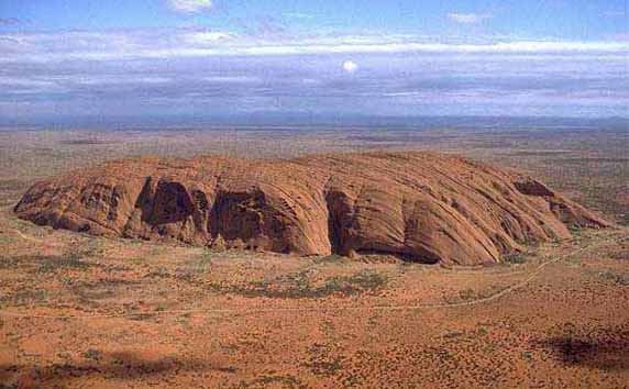
Uluru is composed of hard sandstone which has been exposed as a result of folding, faulting and the erosion of surrounding rock. The monolith has a base circumference of 9.4 km, smooth sloping sides of up to 80° gradient and a relatively flat top. Major surface features of the rock include sheet erosion with layers 1-3 m thick, parallel to the existing surface, breaking away; deep parallel fissures which extend from the top and down the sides of the monolith; and a number of caves, inlets and overhangs at the base formed by chemical degradation and sand blast erosion.
Kata Tjuta comprises 36 steep-sided rock domes of gently dipping Mount Currie conglomerate consisting of phenocrysts of fine-grained acid and basic rocks, granite and gneiss in an epidote-rich matrix. Kata Tjuta tends to have hemispherical summits, near-vertical sides, steep-sided intervening valleys and has been exposed by the same process as Uluru.
The local indigenous community request that visitors respect the sacred status of Uluru by not climbing the rock, with signs posted to this effect. In 1983 the former Prime Minister of Australia, Bob Hawke, promised to respect the request from the community that climbing Uluru be prohibited, but broke his promise when title was handed to the traditional owners in 1985 because access for tourists to climb Uluru was made a condition before they could receive the title. The climb crosses an important dreaming track, which has been a cause of sadness and distress among traditional owners. Neverthless, they are unable to prohibit climbing, and climbing Uluru is a popular attraction for a large fraction of the many tourists who visit it each year. A rope handhold makes the climb easier, but it is still quite a long and steep climb and many intended climbers give up partway up. There are several deaths a year as a direct result of climbing the rock, mainly from heart failure.
The Rock is arkose, a course-grained sandstone rich in feldspar at least 2.5 km thick. Uplifting and folding between 400-300 mya turned the sedimentary layers nearly 90 degrees to their present position. The surface has then been eroded.
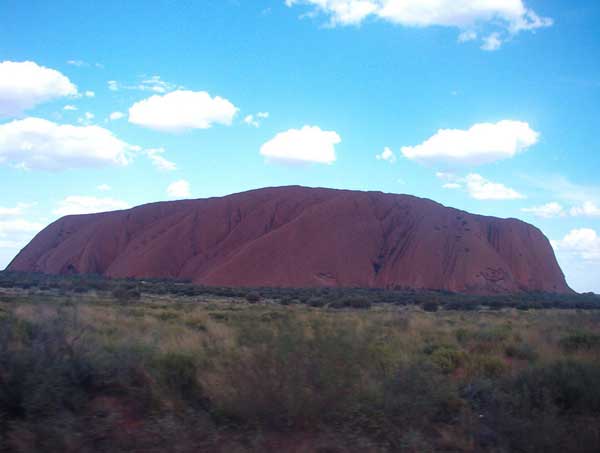
Depending on the time of day and the atmospheric conditions, the rock can dramatically change color, anything from blue to violet to glowing red (I bold and underline this sentence because this is the great view and interesting moments you must see). Many avid photographers set up for days and record the many changing colors of Uluru.
In Uluru, You can also do some caving activity. The caves in Uluru can be both engaging and enlightening. To truly experience the power of Ayers Rock, your journey should be more than a few hours. Make the proper adjustments to your personal life such as hiring a telephone answering service to handle customer service for any business you may own and coordinating with your friends and family to maintain other aspects of your home life while you are gone. Take your time to absorb the history of the springs, caves, and ancient paintings throughout the formation and don't worry about running your business. The first Aboriginal settlers arrived there more than 10,000 years ago and created a historical journey that would be difficult to transverse overnight so the recommendation for any tourists traveling to the formation has always been to allow more time to absorb the area without being distracted.
A 9 kilometre, 5.6 mile walking track circles the base of Uluru giving visitors the opportunity to see some Aboriginal rock art and also the Mutitjulu Waterhole.
There is a treacherous 1.6 kilometre, 1 mile climb to the top of Uluru however the route follows a sacred religious track. Anangu prefer visitors respect their site by choosing the trails around and near Uluru and not by climbing it.
The walk trails around Uluru reveal Anangu stories and law as you reach each significant site. Your behaviour will determine the depth of your experience at Uluru. The area around the Mala waterhole, for example, bequests silence in respect for the significance of the place. Take the time to fit in with the appropriate behaviours and you will be rewarded with a very soulful experience of Uluru.
Sunset and sunrise over Uluru and Kata Tjuta are spectacular, with the colours at both sites becoming more vibrant and even changing. Uluru and Kata Tjuta have significant meaning to Aboriginal people. They both form an important focus of their spiritual life.
How To Get To Uluru
Uluru-Kata Tjuta National Park is located in the south-west region of the Northern Territory. It is approximately 440 km south-west of Alice Springs.
The easiest way to get into the park is to drive, catch a bus or join a tour from Alice Springs. You can also fly from most capital cities to Ayers Rock Airport (Yulara), which is located just outside the park. Contact your travel agent for more details. Car hire is available from the airport and is best arranged through your travel agent before arrival.
The most logical way to get to Uluru from Sydney by road is the following:
- head west along the South Western Motorway which then becomes the South Western Freeway
- continue along as the Hume Highway
- bear left towards Tarcutta on the Sturt Highway, continuing right through to Mildura in far western Victoria
- continue along towards Barmera and Morgan, then turn northwest towards Port Augusta.
- continue north up the Stuart Highway until you reach the junction of the Lasseter Highway
- Turn left down the Lasseter to get to Uluru / Ayers Rock
This covers a distance of 2820 kilometres, and such a trip should be spread over many days. Many people merely take a flight from Sydney to Alice Springs, then a flight or bus to Uluru. There are daily flights to Ayers Rock Airport from Perth, Sydney, Melbourne, Cairns and Alice Springs direct to Ayers Rock Airport.


 9:32 PM
 Unknown


 Posted in:


0 comments:
Post a Comment