Sunday, March 11, 2012

Prambanan Temple, Indonesia

            Ex-Travel-Ganzer Buddy, ets continue our journey travelling around the world. We are going to continue our journey in the most romantic site – yes, a place we are going to visit is famous with it love story-. The power of love has bring some place is very special and very attractive. So i hope that you dont need to prepare any chocolate, a bucket of flower or romantic candle light dinner to tell the true about your heart. Let the temple speak for you....hahaha, iam just kidding, so lets jump to the our main stream point. So lets go to Jogjakarta.
Prambanan Temple, Indonesia
 Yogyakarta is the most popular tourist destination on Java. Famous for its rich heritage, cultural performances such as gamelan music, classical dance, shadow puppet shows, can be enjoyed daily. It is also a good base for day trips to 2 of the world's most impressive archeological sites - Borobudur & Prambanan Temple complexes. Yogyakarta also has excellent budget food & accommodation options and has been a travelers favorite for many years. Right now, we are going to talk only about Prambanan Temple, Maybe next time we will move to Borobudur.
Prambanan Temple, Indonesia
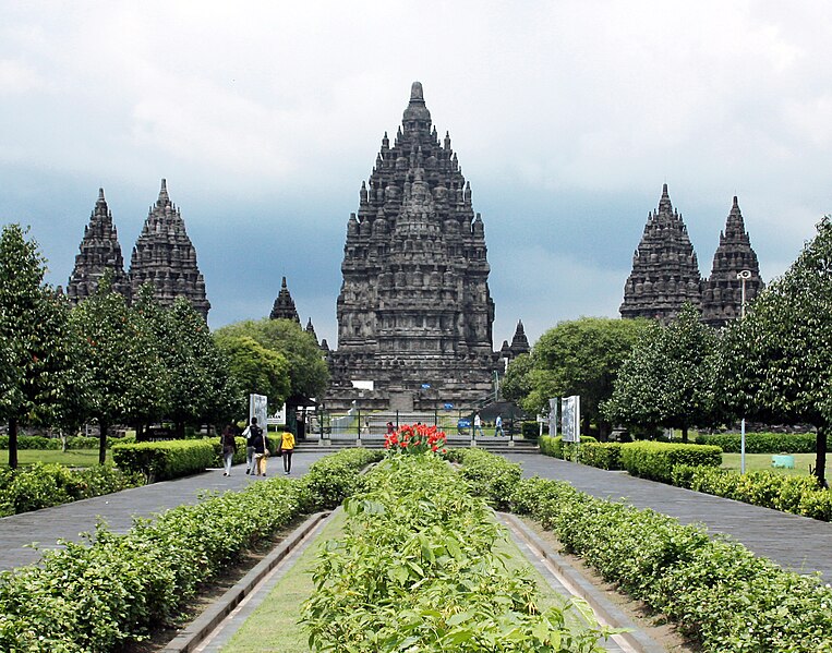
 Prambanan temple is extraordinarily beautiful building constructed in the tenth century during the reigns of two kings namely Rakai Pikatan and Rakai Balitung. Soaring up to 47 meters (5 meters higher than Borobudur temple), the foundation of this temple has fulfilled the desire of the founder to show Hindu triumph in Java Island..Candi Prambanan is the grandest temple in Java apart from Borobudur. Located on the Prambanan plain, this sprawling temple complex sits majestically in an open area about twenty kilometers south of Mount Merapi, which dominates the horizon. This temple also located 17 kilometers from the city center, among an area that now functions as beautiful park.
Prambanan Temple, Indonesia

Originally there was total 240 temples stood in Prambanan. The Prambanan Temple Compound consist of:
1.      3 Trimurti temples: three main temples dedicated to Shiva, Visnu, and Brahma
2.   3 Vahana temples: three temples in front of Trimurti temples dedicated to the vahana of each gods; Nandi, Garuda, and Hamsa
3.   2 Apit temples: two temples located between the rows of Trimurti and Vahana temples on north and south side
4.      4 Kelir temples: four small shrines located on 4 cardinal directions right beyond the 4 main gates of inner zone
5.      4 Patok temples: four small shrines located on 4 corners of inner zone
6.    224 Pervara temples: hundreds of temples arranged in 4 concentric square rows; numbers of temples from inner row to outer row are: 44, 52, 60, and 68.
Prambanan Temple, Indonesia
 Candi Prambanan is often called Loro Jonggrang temple after the local name of the Durga statue enshrined in one side of the Shiva temple (Loro Jonggrang means "Slender Virgin"). The substitution of Durga for a more locally-derived god occurred through the fame of an ancient legend. According to legend, the statue of Durga is actually the petrified body of Loro Jonggrang, the daughter of King Ratu Boko. When prince Bandung Bandawasa asked for her hand in marriage, the king answered that he could have her only if he could kill him in battle. In the ensuing fight, the prince killed Ratu Boko. Loro Jonggrang did not wish to marry the murderer of her father, so she asked of him an impossible task: build 1,000 temples in one night. If he fulfilled the task, he could marry her. 
Prambanan Temple, Indonesia
 Bandung nearly accomplished the job by securing an army of spirits through the help of his dead father. The supernatural laborers erected temples at lightning speed, and Loro Jonggrang realized that Bandung would finish before daybreak. To stop him, Loro Jonggrang pounded on a rice block, making the cocks in the neighborhood wake up early and call the arrival of dawn. Hearing this, Bandung's army of spirits feared the daylight and rushed away from their work, leaving just a single temple unfinished. In fury, Bandung cursed Loro Jonggrang and had her body turned to stone. Through the intervention of Shiva, the petrified body became the idol that now stands in the north cella of the Siva temple at Candi Prambanan. 
Prambanan Temple, Indonesia

In recent centuries, the fame of Loro Jonggrang spread far and wide, and the original purpose of the temple was forgotten as worshippers flocked to her small cella, leaving offerings of food, money, and gifts. Early foreigners who visited the temple often had trouble reaching the statue with all of the offerings clogging the narrow passage. Of the idol herself, the numerous hands of the worshippers had rubbed the breasts and stomach to a smooth sheen, giving the appearance of shining metal.
Right now, beside visiting the temple, enjoying the view, and feeling the true love behind the “making of this temple by Bandug bondowoso, you can also enjoying Sendratari that always performing in few special moments.

In the early 1990s the government removed the market that had sprung up near the temple and transformed the surrounding villages and rice paddies into an archaeological park. The park covers a large area, from Yogyakarta-Solo main road in the south, encompassing the whole Prambanan complex, the ruins of Lumbung and Bubrah temples, and as far as the Sewu temple compound in the north. In 1992 the Indonesian government created a State-owned Limited Liability Enterprise (PERSERO) of PT Taman Wisata Candi Borobudur, Prambanan, dan Ratu Boko. This enterprise is the authority for the park management of Borobudur Prambanan Ratu Boko and the surrounding region. Prambanan is one of the most visited tourist attraction in Indonesia.
The open-air and indoor stages on the west side of the temple right across the Opak river, were built to stage the Ramayana ballet. This traditional Javanese dance is the centuries old dance of the Javanese court, performed every full moon night in the Prambanan temple since the 1960s. Since then, Prambanan has become one of the major archaeological and cultural tourism attractions in Indonesia.
Prambanan Temple, Indonesia

After the reconstruction of the main temples in 1990s, Prambanan once again reclaim its status as an important religious center for Hindu rituals and ceremonies in Java. The religious significance revival of Prambanan was due to Balinese and Javanese Hindu communities in Yogyakarta and Central Java that annually perform their sacred ceremonies in Prambanan, such as Galungan, Tawur Kesanga, and Nyepi.
The temple was damaged during the May 2006 Java earthquake. Early photos suggested that although the complex was structurally intact, the damage was significant. Large pieces of debris, including carvings, were scattered over the ground. The temple was closed to visitors until the damage could be fully assessed. Eventually, the head of Yogyakarta Archaeological Conservation Agency stated that it would take months to identify the precise extent of the damage. However, some weeks later in 2006 the site was re-opened for visitors. In 2008, 856,029 Indonesian visitors and 114,951 foreign visitors has visited Prambanan. In 6 January 2009 the reconstruction of Nandi temple finished. As of 2009, the interior of most of the temples remains off-limits for safety reasons.
Prambanan Temple, Indonesia
 The prambanan temple site has been protected by Unesco as one of the world heritage that must be cared because the uniqueness. The list number is 642. So you dont have to have reason to neglect this place as one of your destination if you visit Indonesia because you will never regret, in case  you will get use to it. You can enjoy it with someone that you really love it. I suggest this place and i recommended it for you. Dont worry, everything near Prambanan is very cheap, the culinary, the hotels, the gifts and anything.

How To Get To Prambanan Temple
Prambanan Temple, Indonesia

If you flight from abroad, just make sure you take a flight from your country to Jakarta. From jakarta there so many transportation mode you can take to reach Jogjakarta, the place of Prambanan Temple.
If you plan use Plane, is about 1 hours from Soekarno Hatta International Airport and you will arrive at Adi sucipto Airport. From airport just take taxi or busway. You will get there directly in one blink..hahaha, just kidding because it will take about 15 minutes to get there.
If you want to enjoy your traveling use train, you can buy ticket in gambir station in jakarta and choose Jogjakarta as your end destination. When you already in Yogyakarta Train Station after 9-10 hours travelling from Jakarta – Yogyakarta. You can use taxi to reach Prambanan or just cross the roads and take Busway from busway station in front of the station.
I will not recommend you to use bus. But if you still want to reach jogjakarta by bus, start your trip from Lebak Bulus Bus Station in Jakarta and it will take about 12 hours to reach Jogjakarta. Soon you arrive at Jogjakarta just take taxi to reach the Prambanan temple.

Saturday, March 10, 2012

Socotra Island, Yemen

 Iam not kidding when i say this island looks like an alient camp in our lovely earth. But this is the main reason why you must see, observe, travel and enjoy some time in this island. Ex-Travel-Ganzer, welcome to the real alien world in the world, at the southern of Yaman, please welcome the most bizzare, strange but at the same time wonderfull island to be explored.
Socotra Island, Yemen
             Welcome aboard to Socotra Island in Yemen. Socotra name from the word of Sanskrit “sukhadhara dvipa” which meaning as “Happiness Island”. The archipelago consists of the main island of Socotra, and three smaller islands of Abd al Kuri, Samhah and Darsa. There are also small rock outcrops like Ka'l Fir'awn and Sābūnīyah that are uninhabitable by humans but important for seabirds. This island is a perfect destination to explore. You will found unusual feature of island, hiking the mountains, and relaxing in tropical beach.
Socotra Island, Yemen
 Socotra as most beautiful island in the Middle East, almost everything is strange in different: wildlife, nature, flora and fauna, bizarre of rock and stone formation. Socotra also has beautiful beaches. Scuba divers and snorkel will be surprise with amazing untouched coral reefs with many endemic species in the warm of Arabian Sea and Indian Ocean.
Socotra Island, Yemen
 In Socotra, you will touch and see many things which is seldom found anywhere else in this planet. All of that makes your holiday in Socotra is perfectly a new tourism destination in the world. Socotra is the real of exotic garden in the world with prehistorical landscape and wild life. So amazing and fantastic holiday destination!
The Socotra Archipelago forms part of the Republic of Yemen, and is located in the northwestern Indian Ocean, some 350km south of the Arabian peninsula. The archipelago consists of the main island of Socotra (3625 km2 ) and three smaller islands, Abd Al Kuri, Samha and Darsa, and other rock outcrops (Koal Pharawn and Sabunya). Socotra is the largest of four islands of the Socotra Archipelago. Its long geographic isolation has given rise to an abundance of flora and fauna found only on the island. Of Socotra’s 825 plant species, 37% are endemic. Ninety percent of its reptile and 95% of its land snail species are also unique to the island. Not surprisingly, Socotra is increasingly popular with eco-tourists.
Socotra Island, Yemen
 The long geological isolation of the island from neighboring Arabia and Africa, has resulted in very high levels of endemism, which make the archipelago a site of global importance for biodiversity conservation. There are a lot of flora and fauna you can see at Socotra. The most interesting and famous is the species of dragon’s blood tree, the species of dragon’s blood tree is unique to Socotra. The tree is so named because a red resin drips from its bark when pierced. Another is the desert that grow up in the desert. The desert rose is one of the unusual sights of Socotra. Its trunk, which can grow quite bulbous, stores water as a safeguard against dry spells. The desert rose can grow to nearly 10 feet, adding to Socotra’s bizarre landscape. And also you can see unique animal such as An Egyptian Vulture, one of 192 bird species that can be found on Socotra.
Socotra Island, Yemen
 Isolated from continental land masses for 18 million years, Yemen's Socotra Island showcases an alien-like landscape with unusual plants and animals, such as the blood dragon tree, pictured, and desert rose. Its high degree of biodiversity has earned it the name the "Galápagos of the Indian Ocean."
Socotra Island, Yemen
 Socotra is characterized by the Haghier Mountains, reaching 1525 m a.s.l., and located in the north-western part of the island. The eastern and central parts of the island receive some rain during fall and winter, while the western part of the island is arid. In spring, from March to May, temperatures usually rise above 40°C. The climate is characterized by the seasonal Monsoon winds, blowing from the North-East during the period October-May and from South-West during the period June-September. From June to September the island is accessible only by plane, because of exceedingly strong monsoon winds, and access by sea is virtually impossible due to high seas and strong winds all around the island. During this time, fishing is impossible and many people move from the northern coast to the mountains to escape the winds, and to harvest their date palms.
The best time to visit the island is between January and March, when the weather is calm and cool, according to the Socotra Archipelago Conservation and Development Program. Avoid June through September, when Socotra is prone to monsoons. Socotra lacks extensive tourism infrastructure, so visitors should be prepared for a rustic stay.
Socotra Island, Yemen
Recent infrastructure improvements and international acknowledgment have helped Socotra climb out of obscurity. Before an airport opened in 1999, access was only by boat, which was not always an option during the island’s monsoon season. In 2008, UNESCO recognized Socotra Archipelago as a World Heritage Site.

How To Get To Socotra Island

Felix Airlines (Saida) offers four flights per week to socotra islands: Sana’a – Mukalla –Rian – Socotra ( Friday and Wednesday). Also Aden – Mukalla- Rian – Socotra ( Saturday and Monday). Flight duration is approximately 2.5 hours for the flights via Mukalla since the aircraft waits only 30 minutes there.

Friday, March 9, 2012

Malioboro Street Jogjakarta, Indonesia


Hello Ex-Travel-Ganzer. Lets continue our journey to the most buzy”Ness” street in Indonesia. Yes, I am talking about Malioboro Street in Jogjakarta. Malioboro Street located in the heart of Jogjakarta. From this street you can go anywhere you want to go. From this street you can learn also how indonesia culture spread in this street. Why i am saying this street is the most Buzy”ness” because Malioboro street as it is an icon and also the busiest  business district in the area.
Malioboro Street Jogjakarta, Indonesia
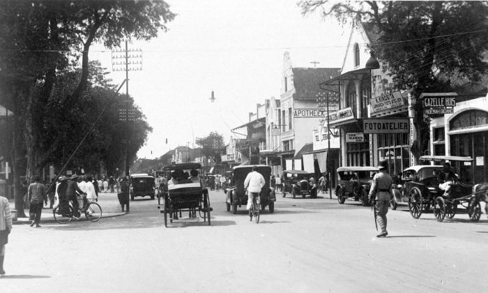
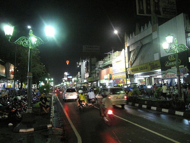
 Coming from the Sanskrit language which means bouquet of flowers, Malioboro becomes flower that its charm is able to attract tourists. Not only full of stories and memories, Malioboro also becomes souvenir paradise in the heart of Jogja. The street is alive 24 hours a day and extends for 3 km from North to South.  At the southern end there is a junction, known as Nol Kilometer (Zero Kilometers). Some people say that Malioboro comes from Marlborough, an English Governor General, who ruled in Yogyakarta during the colonial period. You can see the colonial buildings lining the street combined with a more modern building facade. One of the exciting facades known as Apotik Kimia Farma (Kimia Farma Facade), has a geometric structure and a classically  decorated interior.
Malioboro Street Jogjakarta, Indonesia
 Before it turned into a busy street, Malioboro was a quiet road with a tamarind tree growing on the right and left. This road was just passed by people who wanted to go to the Palace or complex areas such as First Indische first in Yogyakarta, for instance, Loji Besar (Vredeburg Fort), Loji Kecil (area next to the Great Hall/Gedung Agung), Loji Kebon (Great Hall/Gedung Agung), as well as Loji Setan (Office of the Parliament/DPRD office). But the existence of Pasar Gede or Beringharjo Market on the south side and the presence of Chinese ethnic residential in Ketandan area gradually boosted the economy in the region. Chinese group made Malioboro as its business canal, so the trade area which was originally based in Beringharjo and Chinatown eventually expanded to the north to Stasiun Tugu (Tugu Train Station). Seeing Malioboro rapidly growing into the pulse of trade and shopping centers, a friend said that Malioboro is the baby talk for "mari yok borong (let’s buy a lot)". In malioboro you can buy desirable range of merchandise ranging from beautiful accessories, unique souvenirs, classic batik, gold and gems to household appliances. For souvenir fans, Malioboro can be a fun hunting paradise. Walking on the shoulder of the road while bargaining a variety of goods sold by street vendors, will be a special experience. Variety of locally made souvenirs like batik, rattan ornament, silver, bamboo handicrafts, leather puppets, blangkon, miniature of traditional vehicles, accessories, until key chains, all can be found easily. If you are good in bargaining, these items can be taken home with a fairly cheap price.
Malioboro Street Jogjakarta, Indonesia
 So many activities you can do during your traveling. You can take a walk to reach Malioboro. Just started from Tugu Jogjakarta, tugu is the zero point of jogjakarta. From this point you can walk along Mangkubumi street as well as enjoying the old colonialism style building. At the end of mangkubumi street you can find Yogyakarta Train Station. A very old fashioned station. Not quite far from this station you can enjoy cup of coffee. People in jogjakarta called it Kopi Joss, a very unique coffee with unusual taste.
From this point you just cross the rail and walk along Malioboro street. Malioboro street over so many things to see and of course to buy. You dont need to worry because the price of souvenir such as handycraft, Original T-shirt from jogja, Batik and so on is very cheap. The price of Handycraft in along Malioboro street about $3 for each item, the expensive one maybe around $25. For T-shirt, the original one you can get in around $3 and of course you are not officialy go to Jogja if you dont buy batik, a traditional but world class gift for your family. Those you can buy along this street from south to north. But still you can find so many shop that you can entered along this street if you dont like do transaction near the crowdness.
Along this street you can also enjoy the President Place, visiting traditional market called Beringharjo, join tour in Verdeburg Fort. And if you get luck in some precious moments you can enjoy the parade cross this street, at this moments this street looks like very special because the street will be so empty, any kinds of transportation is forbidden to enter this street.

You got hugry?..dont worry you can enjoy so many kinds of Indonesia delicious culinary with very cheap price of course. If you enjoy your dine in the night you can enjoy your meal and at the same time enjoying harmony from musical street. If you got full or you dont like to walk just enjoy your trip useing indonesia traditional transportation called andong.
So What are you waiting for, just visited this place and enjoy your precius moments in here. This place is also good for your honeymoon.

How To Get To Malioboro Street
If you flight from abroad, just make sure you take a flight from your country to Jakarta. From jakarta there so many transportation mode you can take to reach Jogjakarta, the place of Malioboro Street.
If you plan use Plane, is about 1 hours from Soekarno Hatta International Airport and you will arrive at Adi sucipto Airport. From airport just take taxi or busway. You will get there directly in one blink..hahaha, just kidding because it will take about 15 minutes to get there.
Malioboro Street Jogjakarta, Indonesia

If you want to enjoy your traveling use train, you can buy ticket in gambir station in jakarta and choose Jogjakarta as your end destination. Good thing if you use train is you will arrive directly in Malioboro, because Malioboro street is only about “one big step” from Yogyakarta station.
I will not recommend you to use bus. But if you still want to reach jogjakarta by bus, start your trip from Lebak Bulus Bus Station and it will take about 12 hours to reach Jogjakarta. Soon you arrive at Jogjakarta just take taxi to reach and walk in Malioboro.

Palmyra City, Syria

 Ex-Travel-Ganzer, Welcome to Syiria, beautifull country in middle east ( i’m not talking about what happen to this country right now, that not my business). My concern is there is one site thats realy beautifull here and its very useless if we not talk about it, or maybe we dont visit it. May be what people always said about “dont judge the book from the cover” its very fit for this situation. Dont judge Syria right now only because the condition is quite good right now. The important things is there is wonderfull place that can not be compared with anything.
Palmyra City, Syria
 Oke, lets travel right now, we are going to visit Palmyra, a wonderfull site in Syria. Palmyra (Tadmor in Arabic) is in the heart of Syrian Desert, and is often described as the bride of the desert. Its magnificent remains tell of a heroic history during the reign of Queen Zenobia. Beside famous as Tadmor, Palymira also famous with name Tadmur or Tudmur. This palce located 130 Miles/210 Km northeast Damascus and 180 km southwest of the Euphrates at Deir ez-Zor. It had long been a vital caravan stop for travellers crossing the Syrian desert and was known as the Bride of the Desert. The earliest documented reference to the city by its Semitic name Tadmor, Tadmur or Tudmur (which means "the town that repels" in Amorite and "the indomitable town" in Aramaic) is recorded in Babylonian tablets found in Mari.. The name Palmyra means “The City Of Palm Trees” and it was given by Roman rulers in the 1st century. 
Palmyra City, Syria
 Palmyra is Syria’s most famous tourist attraction. Situated at an oasis in the desert, this ruined city is at a considerable distance from any other water source, as it is 150km from the Orontes River in the west and 200km from the Euphrates in the east. The ruins have been extensively excavated and painstakingly restored. An elusive and highly romanticized goal of travelers over the centuries, even today a visit to Palmyra is an experience, which alone makes the trip to Syria worthwhile.
Palmyra City, Syria
 Palmyra appears in the Bible (II Chronicles 8.4) as a desert city fortified by Solomon. (There is a mention of a city of Tamar in I Kings 9.18, also fortified by Solomon, which may refer to Tadmor but could also be a place near the Dead Sea.) Tadmor is also mentioned by Josephus (Antiquities, Book VIII) along with the Greek name of Palmyra, as a city built by Solomon.
The extensive ruins at Palmyra reveal the network plan of the ancient city. The Corinthian order marks almost all the monuments, but the influence of Mesopotamia and Iran is also clearly evident. The art found on monuments and tombs also reflects the influences of the surrounding Roman and Persian empires. As UNESCO puts it, "the art and architecture of Palmyra, standing at the crossroads of several civilizations, married Graeco-Roman techniques with local traditions and Persian influences." The fantastic looks and exotic views make Unesco “Build a huge wall to protect this site”. Unesco listed this site as world heritage with code 23. The reason why Unesco protected this site from the “un-controllable” civilization right now because few criterion such as shown below:
Criterion (i): The splendour of the ruins of Palmyra, rising out of the Syrian desert north-east of Damascus is testament to the unique aesthetic achievement of a wealthy caravan oasis intermittently under the rule of Rome from the Ier to the 3rd century AD. The grand colonnade constitutes a characteristic example of a type of structure which represents a major artistic development.
Criterion (ii): Recognition of the splendour of the ruins of Palmyra by travellers in the 17th and 18th centuries contributed greatly to the subsequent revival of classical architectural styles and urban design in the West.
Criterion (iv): The grand monumental colonnaded street, open in the centre with covered side passages, and subsidiary cross streets of similar design together with the major public buildings, form an outstanding illustration of architecture and urban layout at the peak of Rome's expansion in and engagement with the East. The great temple of Ba'al is considered one of the most important religious buildings of the 1st century AD in the East and of unique design. The carved sculptural treatment of the monumental archway through which the city is approached from the great temple is an outstanding example of Palmyrene art. The large scale funerary monuments outside the city walls in the area known as the Valley of the Tombs display distinctive decoration and construction methods.
Palmyra City, Syria
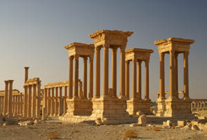
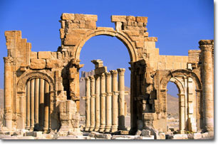
 The Temple of Bel on the eastern edge of the site has a huge courtyard, which is 200 metres square. The Great Colonnade lined with columns, was once the city’s main street. The Monumental Arch at one end of the colonnade has been partially restored. The Theatre, Market Place and Banqueting Hall are located on the southern side of the colonnaded street. Other buildings, such as baths and temples are scattered on either side of the main street.
Palmyra City, Syria
 Other ruins include a vast complex called Diocletian's Camp and the chief Palmyrene temple sanctuary, dedicated to Bel, Yarhibol, and Aglibol. Palmyra's museum, between the ruins and the new town, contains statues and objects excavated from the site.
The city’s museum, situated between the ruins and the new town, contains many statues and objects, which have been excavated from the site.

Outside the ancient walls, the Palmyrenes constructed a series of large-scale funerary monuments which now form the so-called Valley of the Tombs, a 1 km long necropolis, with a series of large, richly decorated structures. These tombs, some of which were below ground, had interior walls that were cut away or constructed to form burial compartments in which the deceased, extended at full length, were placed. Limestone slabs with human busts in high relief sealed the rectangular openings of the compartments.
These reliefs represented the "personality" or "soul" of the person interred and formed part of the wall decoration inside the tomb chamber. A banquet scene depicted on this relief suggests a family tomb rather than that of an individual.
Palmyra City, Syria
 Archaeological teams from various countries have worked on-and-off on different parts of the site. In May 2005, a Polish team excavating at the Lat temple discovered a highly-detailed stone statue of the winged goddess of victory Nike.
Recently, archaeologists in working in central Syria have unearthed the remnants of a 1,200-year-old church believed to be the largest ever discovered in Syria, at an excavation site in the ancient town of Palmyra. This church is the fourth to be discovered in Palmyra. Officials described it as the biggest of its kind to be found so far — its base measuring an impressive 51 by 30 yards. The church columns were estimated to be 20 feet tall, with the height of the wooden ceiling more than 49 feet. A small amphitheater was found in the church's courtyard where the experts believe some Christian rituals were practiced. In November 2010 Austrian media manager Helmut Thoma admitted to looting a Palmyrian grave, where he has stolen architectural pieces, today presented in his private living room. German and Austrian archaeologists protested against this crime.
Palmyra City, Syria

How To Get To Palmyra.


Palmyra was an important city located in an oasis 215 km northeast of Damascus and 180 km southwest of the Euphrates at Deir ez-Zor
Syria’s airline proposed domestic flights from Damascus to Deir ez-Zur for one hour. from Deir ez-Zur you can reach Palmyra from Deir ez-Zur by taxi (three hours). Use bus or taxi services from Damascus to Palmyra (three or four hours). If you were in a car and maintained an average speed of 60mph (96 kmh) over the course of your journey it would take you around 2.3 hours to get from Palmyra to Damascus.

Tuesday, March 6, 2012

Lake Taupo, New Zealand

 After work in five days, in months, in year. You have accumulate tired in your boddy, the time has come to you to do some traveling. I suggest you to travel where you can rest your eye, hear the beautifull song sang by blue water, relax your body with the beautifull of nature, fresh your lung with the clean oxygen surrounded the very green forest. You will free like in heaven soon when you come back to your bed.
Lake Taupo, New Zealand
 I pronounce you the best place, the heaven of the world, that you never forget in the rest of your life. Lake Taupo, a very best lake i thing. Lake Taupo is a lake situated in the North Island of New Zealand. With a surface area of 616 square kilometres (238 sq mi), it is the largest lake by surface area in New Zealand, and the second largest freshwater lake by surface area in geopolitical Oceania after Lake Murray (Papua New Guinea).
Lake Taupo, New Zealand
 Lake Taupo has a perimeter of approximately 193 kilometres, a deepest point of 186 metres. It is drained by the Waikato River (New Zealand's longest river), while its main tributaries are the Waitahanui River, the Tongariro River, and the Tauranga Taupo River. It is a noted trout fishery with stocks of introduced brown trout and rainbow trout.
Surrounded by stunning volcanoes, bush clad mountains and a spectacular landscape lies the largest freshwater lake in New Zealand and the Southern Hemisphere, Lake Taupo.  The water is stunningly blue - the air fresh and unpolluted - the towns are bustling with cafes and exclusive shopping - scenic delights greet visitors at every turn. See the clear blue waters on a summer’s day and Lake Taupo can appear the most beautiful and tranquil place in New Zealand. Appearances deceive. Taupo is more than a lake. It is a volcano with no top – a top that was blown off in one of the largest and most devastating eruptions ever seen on the planet. Visit the Craters of the Moon and you will see evidence of its fiery birth in the geysers, steaming craters and boiling mud pools.
Lake Taupo, New Zealand

Some of the best trout fishing in the world has international anglers flocking to the area while mighty mountain peaks draw skiers and adventurers alike to experience the pristeen environment. Clean Green New Zealand - this is it. Other scenic highlights include the magnificent Huka Falls, where more than 220,000 litres of water thunder over the cliff face every second and the Aratiatia Rapids. Take a trip to Tongaririo National Park World Heritage Area; a brilliant place for skiing in the winter and for hiking in the summer. Taupo is a great lake for adventure with water-skiing, parasailing, jet-skiing and kayaking but what it’s really well known for is fishing. The largest natural trout fishery in the world this is the place to cast a line and look for the big one. There’s a genuinely friendly local culture in Taupo and the surrounding towns and accommodation is plentiful. So why not stay awhile.
Lake Taupo, New Zealand
 Experience the vocanic wonders of the Tongariro National Park or undertake the stunning Tongariro Crossing one day walk. Adventures in the Taupo region include jet boating, sky diving, bungi jumps, mountain biking or just plain relaxing besides the great lake or in a volcanic hot pool.
There are two sides to the Great Lake Taupo region: action packed adventure and relaxing leisure. You can say that we have the yin and yang of life.
Lake Taupo, New Zealand

The relaxing and tranquil side many visitors crave can be sought in the thermal hot pools and spas, quiet walking trails, world class golf courses and many beautiful scenic attractions, especially our main asset - the Great Lake.
For the adventure seeker, heart pumping adventure activities such as skydiving, mountain biking, bungy jumping and jet boating can be found all around Great Lake Taupo.
Lake Taupo, New Zealand


Great Lake Taupo is a water lover’s paradise. Boating, sailing, swimming, kayaking and parasailing are all sought after activities on the crystal blue Lake Taupo.  The Great Lake Taupo region's rivers also enjoy a reputation as one of the world’s best trout fishing destinations.
The Great Lake Taupo region is bustling with boutique shops, cosy cafes and award winning restaurants.  It's also great for the little ones as there are plenty of family activities to do in the region. Try your hand at prawn fishing or have a picnic by the lake. Or take the kids on an educational tour visiting the many attractions and museums that celebrate the area's vibrant culture and history.
Lake Taupo, New Zealand

Located in the heart of New Zealand’s North Island, Great Lake Taupo is undoubtedly one of the world’s most unique and picturesque areas.  The film location for The Lord of The Rings trilogy and the upcoming The Hobbit movie, the region is centred around the majestic Lake Taupo, the largest freshwater lake in Australasia. 
Great Lake Taupo Activities are as diverse as the landscape itself, which boasts beautiful geothermal scenery, breath taking waterfalls and world heritage listed forest reserves. You’ll see spectacular steaming cliffs, geysers, boiling lakes, bubbling mud pools and many thermally heated hot pools as well as the mighty Huka Falls, New Zealand’s most visited natural attraction. Marvel at Huka Falls the most visited natural feature in New Zealand, climb the volcanoes or explore the wider region with extensive farmlands, mountains, bush and rivers.
Lake Taupo, New Zealand

On the north west side of Lake Taupo on the cliffs of Mine Bay, there are Māori rock carvings created in the late 1970s by Matahi Whakataka-Brightwell and John Randall. Carved in likeness of Ngatoroirangi, a navigator who guided the Tuwharetoa and Te Arawa tribes to the Taupo area over a thousand years ago according to Māori legend. The 10-metre-high carving is intended to protect Lake Taupo from volcanic activities underneath. The cliff has become a popular tourist destination with hundreds of boats and yachts visiting the spot daily.

How To Get To Lake Taupo

Located in the centre of the North Island, Great Lake Taupo is an ideal ocation to stop and stay. 
In the early days of our history, getting to New Zealand was as much of an adventure as the experience when you arrived. Happily, it’s very different today. Flights come here from all over the world. New Zealand is just a short 3 hours from Sydney, an easy 12 hour overnight flight from Los Angeles, and up to 25 hours from Europe. And depending on where you’re coming from there are any number of airports that you can fly into, in both the North and South Islands, so you’re close to where you want to be.of course, you could also arrive here in leisure and comfort, on a cruise. 
Cruising to New Zealand is a time-honoured tradition; it’s how the early settlers arrived here. New Zealand welcomes cruises from Australia and the Pacific Islands as well as expedition cruises bound for Antarctica. And with New Zealand’s compact land, cruising is a brilliant way to see the country with each region being within overnight steaming of each other.
If travelling by car, make Great Lake Taupo your base camp – within a short distance you have a diverse region to explore.
Great Lake Taupo’s location at the crossroads of the North Island has a lot of advantages.  State Highway 1 is the main arterial route for the North Island.  It links Auckland and Wellington.  From Taupo, Auckland is 3.5 hours to the north.  Wellington is a leisurely 5.5 hours south.
State Highway 5 - the Thermal Explorer Highway - is a busy visitor route that runs from sunny Hawke`s Bay Wine Country (a two hour drive to the south-east) to Rotorua (a one hour drive to the north-east). 
The famous Waitomo Caves are also a short two hour drive from Taupo.
Closer to Lake Taupo you will find the trout fishing mecca of Turangi, and the quiet lakeside town of Mangakino. The world famous Tongariro National Park (and Tongariro Northern Circuit) are also close by.

Monday, March 5, 2012

Uluru Rock Mountain/Ayers Rock Mountain, Australia


Hello Ex-Travel-ganzer, are you doing great today to start the journey and to enjoy the beautifull of nature. Yes, as you can see that all the things in this world is heaven and God never create all of the things for useless. Everything has their own has story and everything share  different “Magics”words.
Uluru Rock Mountain/Ayers Rock Mountain, Australia
 So iam going to welcoming all of you to the beautifull recogniseable natural landmarks in the world. You may already see many times this place appeared in movies or on postcards. But still it would be very beautifull if you can see this place directly in State Northern Country, Australia. Yeah, we are going to visit Ayers Rock.
Uluru Rock Mountain/Ayers Rock Mountain, Australia
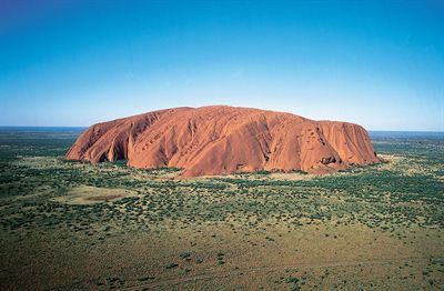
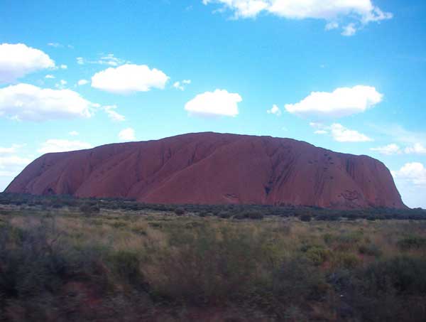
 Ayers Rock is also known by its Aboriginal name 'Uluru'. It is a sacred part of Aboriginal creation mythology, or dreamtime - reality being a dream. Uluru is considered one of the great wonders of the world and one of Australia's most recognizable natural icons. Uluru is a large magnetic mound large not unlike Silbury Hill in England. It is located on a major planetary grid point much like the Great Pyramid in Egypt.
Uluru Rock Mountain/Ayers Rock Mountain, Australia
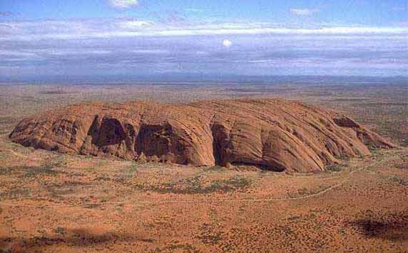
 Uluru is a large sandstone rock formation in central Australia, in the Northern Territory. It is located in Uluru-Kata Tjuta National Park, 350 km southwest of Alice Springs at 25 degrees 20' 41" S 131 degrees 01' 57" E. It is the second-largest monolith in the world (after Mount Augustus, also in Australia), more than 318 m (986 ft) high and 8 km (5 miles) around. It also extends 2.5 km (1.5 miles) into the ground. It was described by explorer Ernest Giles in 1872 as "the remarkable pebble".
On 19 July 1873, the surveyor William Gosse sighted the landmark and named it Ayers Rock in honour of the then Chief Secretary of South Australia, Sir Henry Ayers. Since then, both names have been used.
Uluru Rock Mountain/Ayers Rock Mountain, Australia

In 1993, a dual naming policy was adopted that allowed official names that consist of both the traditional Aboriginal name and the English name. On 15 December 1993, it was renamed "Ayers Rock / Uluru" and became the first official dual-named feature in the Northern Territory. The order of the dual names was officially reversed to "Uluru / Ayers Rock" on 6 November 2002 following a request from the Regional Tourism Association in Alice Springs.
In the early 1900s the Government declared ownership of the land and by the 1950s tourists and miners had begun to make tracks to Uluru and Kata Tjuta. At the time only a few Anangu were living at Uluru. However, as tourist numbers grew, most of the Anangu there scattered into other regions within Central Australia.
Uluru Rock Mountain/Ayers Rock Mountain, Australia

By the early 1970s, the pressure of tourism was having detrimental effects on the environment and the government agreed in 1973 to relocate accommodation facilities to a new site.
It was not until 1979 that, in recognition of the existence of traditional Aboriginal owners of Uluru and Kata Tjuta, a national park was acknowledged. In 1983 Prime Minister Hawke announced the government's intention to grant ownership of the land back to the traditional owners. The agreement, however, required the traditional owners to lease the park to the Australian National Parks and Wildlife Service for a period of 99 years.
This park features spectacular geological formations that dominate the vast red sandy plain of central Australia. Uluru, an immense monolith, and Kata Tjuta, the rock domes located west of Uluru, form part of the traditional belief system of one of the oldest human societies in the world. The traditional owners of Uluru-Kata Tjuta are the Anangu Aboriginal people.
Uluru is composed of hard sandstone which has been exposed as a result of folding, faulting and the erosion of surrounding rock. The monolith has a base circumference of 9.4 km, smooth sloping sides of up to 80° gradient and a relatively flat top. Major surface features of the rock include sheet erosion with layers 1-3 m thick, parallel to the existing surface, breaking away; deep parallel fissures which extend from the top and down the sides of the monolith; and a number of caves, inlets and overhangs at the base formed by chemical degradation and sand blast erosion.
Uluru Rock Mountain/Ayers Rock Mountain, Australia
 Kata Tjuta comprises 36 steep-sided rock domes of gently dipping Mount Currie conglomerate consisting of phenocrysts of fine-grained acid and basic rocks, granite and gneiss in an epidote-rich matrix. Kata Tjuta tends to have hemispherical summits, near-vertical sides, steep-sided intervening valleys and has been exposed by the same process as Uluru.
The local indigenous community request that visitors respect the sacred status of Uluru by not climbing the rock, with signs posted to this effect. In 1983 the former Prime Minister of Australia, Bob Hawke, promised to respect the request from the community that climbing Uluru be prohibited, but broke his promise when title was handed to the traditional owners in 1985 because access for tourists to climb Uluru was made a condition before they could receive the title. The climb crosses an important dreaming track, which has been a cause of sadness and distress among traditional owners. Neverthless, they are unable to prohibit climbing, and climbing Uluru is a popular attraction for a large fraction of the many tourists who visit it each year. A rope handhold makes the climb easier, but it is still quite a long and steep climb and many intended climbers give up partway up. There are several deaths a year as a direct result of climbing the rock, mainly from heart failure.
The Rock is arkose, a course-grained sandstone rich in feldspar at least 2.5 km thick. Uplifting and folding between 400-300 mya turned the sedimentary layers nearly 90 degrees to their present position. The surface has then been eroded. 
Uluru Rock Mountain/Ayers Rock Mountain, Australia

Depending on the time of day and the atmospheric conditions, the rock can dramatically change color, anything from blue to violet to glowing red (I bold and underline this sentence because this is the great view and interesting moments you must see). Many avid photographers set up for days and record the many changing colors of Uluru.
In Uluru, You can also do some caving activity. The caves in Uluru can be both engaging and enlightening. To truly experience the power of Ayers Rock, your journey should be more than a few hours. Make the proper adjustments to your personal life such as hiring a telephone answering service to handle customer service for any business you may own and coordinating with your friends and family to maintain other aspects of your home life while you are gone. Take your time to absorb the history of the springs, caves, and ancient paintings throughout the formation and don't worry about running your business. The first Aboriginal settlers arrived there more than 10,000 years ago and created a historical journey that would be difficult to transverse overnight so the recommendation for any tourists traveling to the formation has always been to allow more time to absorb the area without being distracted.
A 9 kilometre, 5.6 mile walking track circles the base of Uluru giving visitors the opportunity to see some Aboriginal rock art and also the Mutitjulu Waterhole.
            There is a treacherous 1.6 kilometre, 1 mile climb to the top of Uluru however the route follows a sacred religious track. Anangu prefer visitors respect their site by choosing the trails around and near Uluru and not by climbing it.
            The walk trails around Uluru reveal Anangu stories and law as you reach each significant site. Your behaviour will determine the depth of your experience at Uluru. The area around the Mala waterhole, for example, bequests silence in respect for the significance of the place. Take the time to fit in with the appropriate behaviours and you will be rewarded with a very soulful experience of Uluru.
Sunset and sunrise over Uluru and Kata Tjuta are spectacular, with the colours at both sites becoming more vibrant and even changing. Uluru and Kata Tjuta have significant meaning to Aboriginal people. They both form an important focus of their spiritual life.

How To Get To Uluru
Uluru-Kata Tjuta National Park is located in the south-west region of the Northern Territory. It is approximately 440 km south-west of Alice Springs.

The easiest way to get into the park is to drive, catch a bus or join a tour from Alice Springs. You can also fly from most capital cities to Ayers Rock Airport (Yulara), which is located just outside the park. Contact your travel agent for more details. Car hire is available from the airport and is best arranged through your travel agent before arrival.
The most logical way to get to Uluru from Sydney by road is the following:
  • head west along the South Western Motorway which then becomes the South Western Freeway
  • continue along as the Hume Highway
  • bear left towards Tarcutta on the Sturt Highway, continuing right through to Mildura in far western Victoria
  • continue along towards Barmera and Morgan, then turn northwest towards Port Augusta.
  • continue north up the Stuart Highway until you reach the junction of the Lasseter Highway
  • Turn left down the Lasseter to get to Uluru / Ayers Rock
This covers a distance of 2820 kilometres, and such a trip should be spread over many days. Many people merely take a flight from Sydney to Alice Springs, then a flight or bus to Uluru. There are daily flights to Ayers Rock Airport from Perth, Sydney, Melbourne, Cairns and Alice Springs direct to Ayers Rock Airport.

 
Design by Wordpress Theme | Bloggerized by Free Blogger Templates | free samples without surveys