Thursday, March 29, 2012

Venice City and Its Lagoon, Italy


Aish, No body would ignore the beauty of this city Ex-Travel-Ganzer, many people has been planning to see this place since along time ago, the wonderfull view, exotic experience and unforgetable moment which hard to be described. Many galleries of photo show how this place offer undeniable journey. Yes, yes. We are going to visi Venice and its lagoon in Italy “Kick The Ball” Country.
Venice City and Its Lagoon, Italy

Venice is regarded by many as one of the most enchanting cities of the world. For much of the Middle Ages and the Renaissance Period, it was also the wealthiest in Europe, when it was a major maritime power, banking on its strategic location as the gateway for commerce between Asia and Europe.
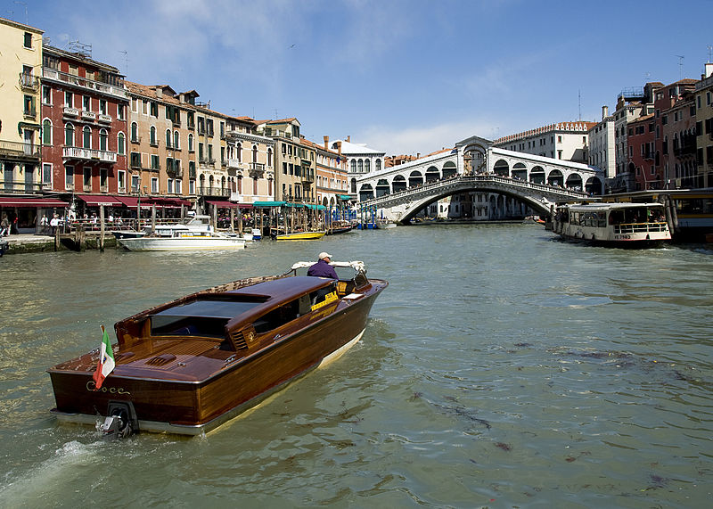
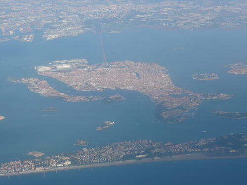
Venice is a unique artistic achievement. The city is built on 118 small islands and seems to float on the waters of the lagoon. The influence of Venice on the development of architecture and monumental arts has been considerable. Venice possesses an incomparable series of architectural ensembles illustrating the age of its splendour. It presents a complete typology whose exemplary value goes hand-in-hand with the outstanding character of an urban setting which had to adapt to the special requirements of the site.
Venice City and Its Lagoon, Italy

In this lagoon covering 50,000 km2, nature and history have been so closely linked since the 5th century AD when Venetian populations, to escape barbarian raids, found refuge on the sandy islands of Torcello, Iesolo and Malamocco. These temporary settlements gradually became permanent and the initial refuge of the land-dwelling peasants and fishermen became a maritime power. The small island of Rialto was chosen as the headquarters of the new city.
The name Venice is believed to come from an ancient tribe known as Veneti, which was mentioned by Homer as the Eneti. The city historically was the capital of the Venetian Republic. Venice has been known as the "La Dominante", "Serenissima", "Queen of the Adriatic", "City of Water", "City of Masks", "City of Bridges", "The Floating City", and "City of Canals". Luigi Barzini described it in The New York Times as "undoubtedly the most beautiful city built by man". Venice has also been described by the Times Online as being one of Europe's most romantic cities.
Venice City and Its Lagoon, Italy

Venice, the island city, was founded in the 5th century. From 697 onwards the Republic of Venice, also called the Serenissima, was ruled by doges. In the 9th century the remains of St. Mark were brought from Alexandria (Egypt) and are kept in the Basilica of San Marco (consecrated in 1094). In the 11th century Venice became a maritime power in the Mediterranean Sea. In the 15th century the dominance of Venice started to decline. The Republic of Venice was ended in 1797 and it became part of Italy in 1866.
Venice located  in northeast Italy which is renowned for the beauty of its setting, its architecture and its artworks. It is the capital of the Veneto region. In 2009, there were 270,098 people residing in Venice's comune (the population estimate of 272,000 inhabitants includes the population of the whole Comune of Venezia; around 60,000 in the historic city of Venice (Centro storico); 176,000 in Terraferma (the Mainland), mostly in the large frazioni of Mestre and Marghera; 31,000 live on other islands in the lagoon). Together with Padua and Treviso, the city is included in the Padua-Treviso-Venice Metropolitan Area (PATREVE) (population 1,600,000).
Venice City and Its Lagoon, Italy

Venice is one of the most important tourist destinations in the world, due to the city being one of the world's greatest and most beautiful cities of art. The city has an average of 50,000 tourists a day (2007 estimate). In 2006, it was the world's 28th most internationally visited city, with 2.927 million international arrivals that year. This site also protected by Unesco as World heritage for few criterian such follow:
Selection criteria:
  •  to represent a masterpiece of human creative genius;
  • to exhibit an important interchange of human values, over a span of time or within a cultural area of the world, on developments in architecture or technology, monumental arts, town-planning or landscape design; 
  •  to bear a unique or at least exceptional testimony to a cultural tradition or to a civilization which is living or which has disappeared; 
  •  to be an outstanding example of a type of building, architectural or technological ensemble or landscape which illustrates (a) significant stage(s) in human history; 
  •  to be an outstanding example of a traditional human settlement, land-use, or sea-use which is representative of a culture (or cultures), or human interaction with the environment especially when it has become vulnerable under the impact of irreversible change; 
  •  to be directly or tangibly associated with events or living traditions, with ideas, or with beliefs, with artistic and literary works of outstanding universal significance. (The Committee considers that this criterion should preferably be used in conjunction with other criteria).
Tourism has been a major sector of Venetian industry since the 18th century, when it was a major center for the Grand Tour, due to its beautiful cityscape, uniqueness, and rich musical and artistic cultural heritage. In the 19th century, it became a fashionable centre for the rich and famous, often staying or dining at luxury establishments such as the Danieli Hotel and the Caffè Florian. It continued being a fashionable city in vogue right into the early 20th century. In the 1980s, the Carnival of Venice was revived and the city has become a major centre of international conferences and festivals, such as the prestigious Venice Biennale and the Venice Film Festival, which attract visitors from all over the world for their theatrical, cultural, cinematic, artistic, and musical productions.
Venice City and Its Lagoon, Italy

Today, there are numerous attractions in Venice, such as St Mark's Basilica, the Grand Canal, and the Piazza San Marco, to name a few. The Lido di Venezia is also a popular international luxury destination, attracting thousands of actors, critics, celebrities, and mainly people in the cinematic industry. The city also relies heavily on the cruise business.
However, Venice's popularity as a major worldwide tourist destination has caused several problems, including the fact that the city can be very overcrowded at some points of the year. It is regarded by some as a tourist trap, and by others as a 'living museum'. The cruise ships that use the Giudecca Canal send a large wake toward the city, that slowly causes the city to sink. Unlike most other places in Western Europe, and the world, Venice has become widely known for its element of elegant decay. The competition for foreigners to buy homes in Venice has made prices rise so highly that numerous inhabitants are forced to move to more affordable areas of Veneto and Italy, the most notable being Mestre.
Venice City and Its Lagoon, Italy

The classic form of transportation in Venice is the gondola. Today it is mostly used by tourists as well as for weddings, funerals and other ceremonies. The main form of transportation is not by gondola, but by vaporetti, or ferryboats.
The best way to see Venice is on foot. Get out your walking shoes as they will be in good use.It is very easy to get lost in Venice, due to the many alleyways and canals which, after a while, tend to look the same. Even maps provided by hotels may be inaccurate or not sufficiently detail. Being on a cluster of islands, you won't wander off it, but you'd certainly lose precious time trying to retrace your steps. One tip is, each time you cross a bridge (and there'll be plenty), to note the house numbers before and after. Another useful tip is to take digital photographs whenever you are at a crossroad, and use the shots to remind yourself the way back. It is recommended that you photograph the view behind you - for that's the direction you need to head on your return. when looking at signs, locations and bridges are marked "Per" followed by the name of the sight. Hence "Per S Marco" points to St Mark's Square. All in all, the experience of Venice comes from exploring its kaleidoscopic sights, even getting lost on occasion.

How To Get To Venice and Its Lagoon.


Venice is served by the Marco Polo Airport (VCE) in Mestre, on the mainland coast of Italy, within sight of Venice. Treviso Airport is a smaller airport of budget airlines such as Ryanair, SkyEurope and Transavia.
From the airport, you can catch the bus to Venice. The shuttle bus between Marco Polo Airport and Venice costs €3.00. Alternatively, you can take a boat at the Alilaguna Waterbus Jetty, which is just 10 minutes walking distance from the airport terminal. The fare of €12 gives you a leisurely 80-minute ride to Piazza San Marco via Murano, Lido and Arsenale. To arrive faster in Venice, you can also opt for a water taxi, which costs €100 for a ride to Piazza San Marco in 30 minutes. The cheaper €6.00 boat goes to Fondamente Nuove, a journey of 30 minutes.

Wednesday, March 28, 2012

Great Barrier Reef, Australia


 Guys, Ready for travelling today?. I am so excited to start my journey to new destination. I always said that heaven is out there so lets reveal the beauty of the world. Right now, we are going to see the heaven in the water world. Iam going to give some clue. This site is very huge and for that reason, this place can be seen if you watch from outer space of the earth. No clue?..just read this article and make sure after you read you have willingness to visit this place.
Great Barrier Reef, Australia
 The Great Barrier Reef is the world's largest coral reef system composed of over 2,900 individual reefsand 940 islands and cays stretching for over 2,600 kilometres (1,600 mi) over an area of approximately 344,400 square kilometres (133,000 sq mi). The reef is located in the Coral Sea, off the coast of Queensland in north-east Australia.
The marine park stretches over 3000km (1800 miles) almost parallel to the Queensland coast, from near the coastal town of Bundaberg, up past the tip of Cape York. The reef, between 15 kilometres and 150 kilometres off shore and around 65 Km wide in some parts, is a gathering of brilliant, vivid coral providing divers with the most spectacular underwater experience imaginable.
Great Barrier Reef, Australia
The Great Barrier Reef Marine Park is 345,000 square kilometres in size, five times the size of Tasmania or larger that the United Kingdom and Ireland combined!
            The reef is immensely diverse. It is home to more than 1,500 species of fish, 411 types of hard coral, one-third of the world’s soft corals, 134 species of sharks and rays, six of the world’s seven species of threatened marine turtles, and more than 30 species of marine mammals, including the vulnerable dugong.
Add to that stunning marine suite as many as 3,000 molluscs and thousands of different sponges, worms and crustaceans, 630 species of echinoderms (starfish and sea urchins) and 215 bird species, of which 22 are seabirds.
The Great Barrier Reef can be seen from outer space and is the world's biggest single structure made by living organisms. This reef structure is composed of and built by billions of tiny organisms, known as coral polyps. It supports a wide diversity of life and was selected as a World Heritage Site in 1981. CNN labeled it one of the seven natural wonders of the world. The Queensland National Trust named it a state icon of Queensland. 
Great Barrier Reef, Australia
 A large part of the reef is protected by the Great Barrier Reef Marine Park, which helps to limit the impact of human use, such as fishing and tourism. Other environmental pressures on the reef and its ecosystem include runoff, climate change accompanied by mass coral bleaching, and cyclic population outbreaks of the crown-of-thorns starfish.
The Great Barrier Reef has long been known to and used by the Aboriginal Australian and Torres Strait Islander peoples, and is an important part of local groups' cultures and spirituality. The reef is a very popular destination for tourists, especially in the Whitsunday Islands and Cairns regions. Tourism is an important economic activity for the region, generating $1 billion per year.
Great Barrier Reef, Australia
 The Great Barrier Reef is one of the most well-known natural attractions, and is the world’s largest coral reef. Great Barrier Reef Queensland stretches for a whopping 2600 kilometres.
The Great Barrier Reef is one of the seven wonders of the natural world, and pulling away from it, and viewing it from a greater distance, you can understand why. It is larger than the Great Wall of China and the only living thing on earth visible from space. The criterion are:
  • to contain superlative natural phenomena or areas of exceptional natural beauty and aesthetic importance;
  • to be outstanding examples representing major stages of earth's history, including the record of life, significant on-going geological processes in the development of landforms, or significant geomorphic or physiographic features;
  • to be outstanding examples representing significant on-going ecological and biological processes in the evolution and development of terrestrial, fresh water, coastal and marine ecosystems and communities of plants and animals;
  • to contain the most important and significant natural habitats for in-situ conservation of biological diversity, including those containing threatened species of outstanding universal value from the point of view of science or conservation.
       One area the Great Barrier Reef reaches is the Whitsunday islands, a popular spot for diving vacations. The 74 islands that make up Whitsunday are surrounded by the Great Barrier Reef Australia, making it the perfect spot to try your hand at diving the Great Barrier Reef.
Diving on the Great Barrier Reef is the best way to experience the thrill of scuba diving. Australia’s Great Barrier Reef travel will let you experience the natural beauty of the reef, as well as its many surrounding areas.
Great Barrier Reef, Australia

The Far North

Cape York, Bamaga, The Daintree Rainforest and Thursday Island Australia are other fantastic areas near the reef, all in tropical North Queensland. Bamaga Queensland offers easy access to Thursday Island, while a Cape York trip might involve taking part in one of the famous Cape York fishing safaris.
Cooktown & Lizard Island Region
Another popular area is Cooktown, along with Lizard Island and the Ribbon Reef region. Cooktown Queensland boasts gorgeous mountain views and the nearby Daintree Rainforest, while Lizard Island Australia features world-class accommodation like the Lizard Island Resort (Hotel). Cooktown accommodation is also of an excellent standard.

Cairns & Port Douglas

Cairns and Port Douglas Australia are also popular far-north destinations. A Port Douglas holiday involves relaxing at hotels, enjoying a Port Douglas restaurant, or using a charter boat to explore the reef. Travel around Port Douglas is made easier with a map of the area.

Hinchinbrook

Hinchinbrook is another northern area worth a visit. Mission Beach lies between the reef and the rainforest, and is a whopping 14km long. Mission Beach Australia also has the advantage point of being right beside the reef. Hinchinbrook Island contains Australia’s largest national park, while Ingham is a pleasant sugar-farming town.

Townsville

Nearby Townsville Australia is an ever-growing city, with attractions galore. Relax at quality Townsville accommodation like a Townsville hotel, or check out the Yongala Wreck which dates back to 1911. Ayr is a nearby small town, in the heart of the sugar cane area. Magnetic Island is just off shore with a ferry service running daily from Townsville.

The Whitsundays

The Whitsunday Islands in the middle of the reef feature numerous attractions. Try Whitsundays diving, private yacht charter or Whitsunday sailing. Areas like beautiful Airlie Beach feature stellar accommodation, while Daydream Island and Hamilton Island are well worth visiting too. Boat charter Whitsunday will allow you to explore such islands as Hook Island, Lindeman Island, and South Molle Island.

Mackay

The coastal city of Mackay lies between Brisbane and Cairns, and has the reef on its doorstep. Mackay is great for fishing, charter boat hire and rainforest walks and treks. The world-class Brampton Island resort in the nearby Whitsunday Islands is well worth a visit, or you could simply enjoy staying at a beach in Mackay Australia.

Capricorn Coast

The Capricorn Coast encompasses Rockhampton, Gladstone, Bundaberg and Yeppoon, and is home to breathtaking landscapes and gorgeous beaches. Rockhampton is the largest town, while the Swain reefs can be found east of Yeppoon, a popular village-like town.
            So what are you waiting for bro and sis, lets visit this site and your drean will come true. You will never know the joyfull of heaven will be found out there.

Great Barrier Reef, Australia
 How To Get To Great Barrier Reef.
The Great Barrier Reef is located in the Coral Sea, just off the northeast coast of the Australian state of Queensland. The reef, as you know, is huge, so it can actually be reached from quite a few different cities and islands along this long coast, although the most popular by far are Cairns, Prosperpine, and Townsville.
Cairns
Being the staging area for most GBR trips, Cairns is quite well known by non-Australians, though it’s not really a particularly large city, with a population of only around 130,000. Particularly for Americans, it can be confusing when locals pronounce it as “cans” in a way that might not ring the Cairns bell in your mind right away. Another thing to remember is this area is tropical, so the climate is very different from Sydney or Melbourne.
Prosperpine
This small city of only about 3,000 is home to an airport that is often referred to as Whitsunday Coast. It’s about 20 kilometers inland from Airlie Beach, which is one of the better GBR trip staging areas.
Townsville
About 220 km up the coast from Airlie Beach you’ll reach Townsville, which is actually about the same size as Cairns, though far less famous internationally. There’s a fairly busy international airport in Townsville, which has a few flights directly from Samoa and New Zealand, though it’s mostly served by Australian cities.

Flying to the Great Barrier Reef

Cairns is by far the most popular flight destination in this region, and you can reach it fairly inexpensively from about 15 large Australian cities, as well as from Bali, Japan, New Zealand, and Singapore. Flights within Australia can range from cheap to insane, and flights into the other two tend to be more regional and more expensive, but if you want to go to one of them flying directly from another Australian city is probably a better option than flying into Cairns and then going from there.
  • Cairns International Airport – Code: CNS
  • Townsville Airport – Code: TSV
  • Prosperpine/Whitsunday Coast Airport – Code: PPP

Getting to the Great Barrier Reef by train

Believe it or not, you can get here on the train, though it’s not cheap or fast. From Sydney you have to take a 14-hour journey to Brisbane, where you’ll spend part of a day and then change to a 3 times per week departure for Cairns, which takes about another full day, so the entire journey takes about 2 days, including half a day waiting in Brisbane. You can take the same method to reach Prosperpine, although that takes about 12 hours less, and Townsville can be reached about 7 hours before the same train gets to Cairns.

Getting to the Great Barrier Reef by bus

The method for getting from Sydney to Cairns by bus is pretty much identical to the instructions by train, although the part from Brisbane to Cairns takes at least a few hours longer. You can buy a bus pass that allows unlimited travel between Sydney and Cairns on these buses, so one of those is probably a far better option that trying to bomb it in one go. 

Tuesday, March 27, 2012

Sian Ka'an, Mexico


Ex-Travel-Ganzer what up??.. this  great day. Because we are going to visit a beutifull country in North America. I think that all people already know this country. We are going to start our journey and our travel to this country because as i remember i havent visit this country to reveal the paradise there. So i think this day is a great day to start this. So i think you are going to join with me. If it is like that, just follow me to reveal the very best spot of heaven in this world.
Yes, we are going to Visit Mexico.  The place is Sian Ka’An.  "Sian Ka’an" is translated from Mayan as "where the sky is born" or "gift from the sky". The reserve is thought to have been inhabited in the pre-Classic and Classic periods as part of the chieftanships of Cohuah and Uaymil.  Sian Ka'an is situated on the eastern side of the Yucatán Peninsula in the state of Quintana Roo. Where possible, boundaries were defined to coincide with natural features: the site is bounded by the Caribbean Sea and the barrier reef to a depth of 50 m in the east; by the junction between the marshes and semi-evergreen forests in the south-east; and by the junction of Chetumal and Espiritu Santo bays catchment basin in the south. The northern and north-eastern boundaries are defined by the limits of farming cooperatives. The northern sites can be reached by a dirt track from Tulum, whereas Punta Pajaros is only accessible by boat or aircraft.
 There are twenty-three known archeological sites inside the reserve. Discoveries of human remains, ceramic pieces, and other artifacts have been dated up to 2,300 years old. The northernmost section of Sian Ka’an contains what is thought to be an ancient trade route through lagoons and mangrove channels between the cities of Tulum and Muyil. Parts of what is now the Reserve were once areas of chicle production and trade through the middle of the twentieth century, and the fishing industry is still one of the most important economic activities of the Reserve’s population. Common species include spiny lobster (Palinurus espinosa) tarpon, grouper, permit, nurse shark, hammerhead, black tipped shark, and snapper. Tourism is a another source of income for fishermen in Sian Ka’an, hired to run boat trips to see the reefs and lagoon systems.. There is a charge of $ 4 USD as a fee entrance to the Reserve per person per day.The Sian Ka’an Biosphere Reserve was established on the 20th of January 1986 by presidential decree (under President Miguel de la Madrid Hurtado) and became part of UNESCO’s Man and the Biosphere (MAB) program that same year. In 1987 the reserve was declared a UNESCO World Heritage Site. As part of the MAB program, Sian Ka’an faces the greatest challenge of conservation: to find a way to integrate human activities without compromising other forms of life contained within its boundaries.
Sian Ka'an, Mexico
 With the participation of scientists, technicians, students, fishermen, farmers, rural promotors and administrators, together with regional and international partners, have successfully carried out more than 200 conservation projects basing all conservation actions on scientific and technical information for planning and implementing environmental policies and the proposal of viable solutions for sustainable use of natural resources and focusing their efforts established within eight protected natural areas that include the reefs of Banco Chinchorro, and Xcalak at South of Quintana Roo, Sian Ka'an Biosphere Reserve, Cancun, the island of Cozumel that is located in front of Xcaret and Contoy Island up North, covering 780,000 acres (3,200 km2). These areas lie in parts of all seven Caribbean Sea coastal municipalities of the state, with the largest part being in eastern Felipe Carrillo Puerto Municipality, where the vast majority of Sian Ka'an Biosphere Reserve lies.
Part of the reserve is on land and part is in the Caribbean Sea, including a section of coral reef. The reserve has an area of 5,280 km². The reserve also includes some 23 known archaeological sites of the Maya civilization including Muyil.
Sian Ka’an is approximately 1.3 million acres in size and spans 120 kilometers from north to south (comprising almost one third of the Caribbean coast of Mexico). In 1994 an area of over 200,000 acres to the south of the Reserve was named a Protected area of Flora and Fauna of Uaymil, increasing the continuous area of protected land.
Sian Ka'an, Mexico
 The reserve contains three large core zones where human activity is limited by permission to scientific research. These areas, known as the Zonas Nucleares of Muyil, Cayo Culebras, and Uaymil, cover a total area of almost 700,000 acres. Low-impact human activities and sustainable development occur in the area of the reserve known as the buffer zone. The human population is estimated at 2,000 inhabitants, the majority of which are located in the coastal regions, especially in the fishing villages of Punta Allen and Punta Herrero. Approximately one percent of the land within the reserve is privately owned.
There are five entrances to the reserve, located at Pulticub, Santa Teresa, Chumpón, Chunyaxché and Chac Mool. Guards employed by the governmental SEMARNAP organization are stationed at every entrance to enforce the Reserve regulations.
Sian Ka'an, Mexico

Habitats found in Sian Ka’an
Coral Reef
The boundaries of the Sian Ka’an Biosphere Reserve include 110km of the second largest barrier reef in the world, which extends onward past Belize and Honduras. The reef is home to many important and several endangered species. Uncontrolled development along the Caribbean coast of Mexico has placed the reef in grave danger, as it is easily damaged and not so easily restored.
Beaches
The beaches of Sian Ka’an constitute a very important habitat and nesting grounds for many species of wildlife, as well as serving as an important transition between land and ocean. Most notably during the months of May through August, the beach is a nesting ground for 4 endangered sea turtle species that have lost important nesting sites along many parts of the Caribbean coast.
Dunes
The coastal dune is an important protector of inland habitats, especially during storms. Coastal vegetation includes Coccoloba uvifera, Tournefortia gnaphalodes, Suriana maritima, Sesuvium portalacastrum, Ambrosia hispida, Ipomoea and many other species. (For a more complete list, refer to flora link).
Wetlands
Mangroves, savannas, swamps and marshes are all included within the classification of “wetland”. Water plays a vital role in the existence of each of these habitats, whether it be fresh, salty, or brackish. Wetlands line the coast of Sian Ka’an, playing an important protective role as a type of buffer between the ocean and the land that can absorb the impact of storms. Wetland areas contain immense biological diversity and are home to a number of endangered species. Evident in all inundated wetlands is a conglomeration of algae known as periphyton that is believed to play an important role in the dissolution of calciferous soils, as well as being an invaluable source of food for many species of fish, mollusks, and insects.
Mangroves
Four species of mangrove line the coastal areas of Sian Ka’an. The mangrove communities are critical for the survival of many species of fish, birds, insects, reptiles, and other plants. Many species of mangrove filter contaminated water and trap loosened sediment, making them protectors of the coral reef and other littoral habitats. The mangrove species found within Sian Ka’an are Rhizophora mangle (red mangrove), Avicennia germinans (black mangrove), Laguncularia racemosa (white mangrove), and Conocarpus erectus (buttonwood mangrove).
Savannas
Coastal savannas are large areas of low-lying land with sparse, oxygen-poor soil that is inundated throughout much of the year. As few tree species have adapted to these conditions, savannas are dominated by species of grass, reeds, and rushes that rarely exceed three meters in height. Inland savannas contain shrubs and occasional trees in addition to grass, are drier and have a lower salinity. These environments are in danger of natural fires during the dry season.
Cenotes or Sink holes
Fresh water contained in the Yucatan’s underground aquifer carves away at the limestone above, weakening it and eventually causing it to give way. The result of this phenomenon is a unique habitat known as a cenote or sink hole. Many cenotes remain connected with the aquifer and with other cenotes through underground passageways. Occasionally, however, cenotes are found to be completely isolated from other bodies of water and may contain fish and other wildlife that have evolved over time into completely distinct species.
Hummocks
Petenes, or hummocks, are isolated areas of forest from several meters to several kilometers in diameter that are surrounded by swamps or inundated savanna land. These formations are found only in Cuba, the Florida Everglades, and the Yucatan Peninsula. There is often a cenote at the center of the hummock, which is surrounded by concentric circles of vegetation, from hardwood trees to grasses and rushes. Common species include cedar, mahogany, and zapote in the center ring, which are surrounded by various palm trees and the poisonwood tree, and eventually mangrove, rushes, and grasses. Many species of fauna live in hummocks, from insects to reptiles, mammals, and birds.
Tasistales
A tasistal is a concentrated strip found within savanna land that contains the tasiste palm (Acoellorraphe wrightii), the grass Cladium jamaicensis, and occasionally other plant species such as poisonwood (Metopium brownei), buttonwood mangrove (Conocarpus erectus), and cocoplum (Chrysalobanus icaco). The tasiste palm is extremely fire-resistant, and will survive natural fires that often strike savanna.
Fresh water lagoons
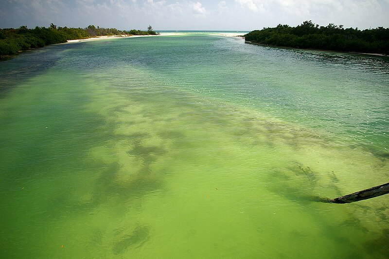
The fresh water lagoons of Sian Ka’an are supplied with fresh water from the subterranean aquifer by small springs or cenotes. Found mostly inland, the fresh water filters toward the ocean in channels or through the surrounding wetlands. The lagoons are home to a number of species of fish and vegetation not found in the coastal areas.
Brackish water lagoons
Ocean water and fresh water from inland and the aquifer meet and mingle in the brackish water lagoons along the coast of Sian Ka’an. These lagoons are lined with salt tolerant mangrove and grass species which provide a home to fish and mollusk species that make the area an attractive nesting ground for wading birds and residence of two crocodile species, Crocodylus moreletii and C. acutus.
Low tropical forest
Many of the mammal species found within Sian Ka’an reside within the low tropical forest land which is located in the westerly portions of the reserve. The forests contain many hardwood species, including chechem, chicozapote, mahogany, tsalam, and other valued hardwoods. The environmental importance of these areas is increased by the international demand for hardwood that is pressuring many countries in the neotropics.
Approximately 36,000 tourists entered the reserve in the year 2000, and those numbers are expected to increase significantly for the year 2001. So this a chance for you to be one of the visitor who visit this site.

How To get To Sian Ka’An
If you choose not to do a tour and explore on your own, you first must travel to Punta Allen. The ride is tough. Renting a 4 wheel drive is your best option. You can also take a bus to Tulum and get a cab or combi (colectivo). The combi leaves every day around 11 a.m. fairly regularly with return trips leaving Punta Allen at around 5 a.m.


Saturday, March 24, 2012

Greater Blue Mountains, Australia

 Australia maybe the smallest continent in the world but Australia is one of continent that offers funtastics journey and joyfull traveling for you who love travelling around the world to see a heaven. As my motto “Paradise is out there” so believe it or not, our destination right now is totally cool destination for you. Wherever you came, what ever you are just believe that you are not gonna miss this biggest experience to travel to the most beautifull continent and country Australia. Lets Begin.
Greater Blue Mountains, Australia
 Okey, we are going to visit Australia, but right now we are not going to visit Uluru. Its oke if youwant to visit Uluru first but please add in your favorite this place along your journey. Yes, iam talking about Greater Blue Mountain.
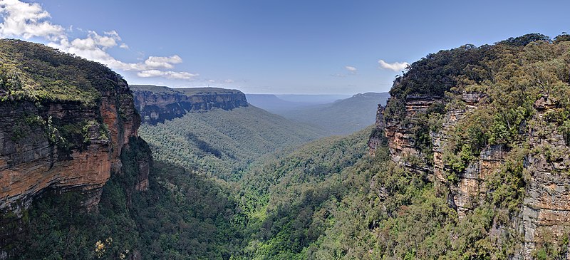
The Greater Blue Mountains Area consists of 1.03 million hectares of sandstone plateaux, escarpments and gorges dominated by temperate eucalypt forest. The site, comprising eight protected areas, is noted for its representation of the evolutionary adaptation and diversification of the eucalypts in post-Gondwana isolation on the Australian continent. There are 91 eucalypt taxa within the Greater Blue Mountains Area, which is also outstanding for its exceptional expression of the structural and ecological diversity of the eucalypts associated with its wide range of habitats. The site provides significant representation of Australia's biodiversity with 10% of the vascular flora as well as significant numbers of rare or threatened species, including endemic and evolutionary relict species, such as the Wollemi pine, which have persisted in highly-restricted microsites.
The rocks which give the Blue Mountains their distinctive character are sandstone plateaus, cliffs and towers, with shales and some granite, basalt, and limestone karst. These originated in a late Cambrian subduction zone which was overlaid by Siluro-Devonian deposits including the carbonate reefs in which the Jenolan caves formed. Subsequent uplift, erosion, marine flooding, deposition and the growth of extensive coal swamps followed. The sandstones and shales, still almost horizontally bedded but now between 500 and 1,000 m high, were laid down as riverine sediments from the Late Permian to the Mid Triassic. The high escarpment may be the result of uplift and tectonic movements in the Cretaceous. But in the rim-rock area of the southwest, very ancient underlyingbasement granites are exposed. Volcanism was an important feature during both the Siluro-Devonian and the Jurassic, periods when a number of volcanic necks were extruded which have now eroded to form circular amphitheaters. More recently, Miocene lava flows formed basalt caps which protect the summits of several mountains such as Mts Wilson, Banks and Tomah.
Greater Blue Mountains, Australia
 The very hard and relatively impermeable sandstones which are highly resistant to erosion are in many areas underlain by much softer shales which erode more easily. This produces slot canyons like the 30 m deep Grand Canyon which is only 3 m wide at the top, that become wide valleys in which small underfit rivers flow where the sandstone cap has collapsed. High cliffs are prominent, including the Cliff Wall which runs from the north of Wollemi National Park almost 280km south, reaching nearly 300m high just south of Wentworth Falls. A large number of spectacular waterfalls cascade from these cliffs. Weathering of joints in the limestone and bands of ironstone produce pinnacles and pagoda-like forms. The sandstone-derived soils are dry, infertile, acidic and phosphorous-poor, but they vary within short distances. There are pockets of volcanic soils and several valley floors are alluvial. There has been some erosion by wind and intense fires, and the superb lyrebird while excavating for food or building nest-mounds could have had some impact on erosion over time since they may turnover an average of 63 tonnes of debris per hectare per year
The Greater Blue Mountains Area located between 32°22’ to 34°23’S and 149° 54’ to 151°07’E. Its eight protected areas preserve a record of the adaptation and diversification of the eucalypts in post-Gondwanan isolation on the Australian continent. The Area has an exceptionally wide range of habitats which contain ninety-two species of eucalyptus, ten percent of Australia's vascular flora and numbers of rare or threatened, endemic and relict species, such as the Wollemi pine, which have persisted for millennia in highly protected micro-sites.  
Greater Blue Mountains, Australia
 The Greater Blue Mountains World Heritage Area embraces over a million hectares of natural bushland extending from the Southern Highlands to the Hunter Valley. From Sydney’s back fence, wild escarpments rise westward to the crest of the Great Dividing Range and the farmlands of the Central Tablelands. 
The World Heritage Area is made up of eight individual nature conservation reserves. These are Yengo, Wollemi, Gardens of Stone, Blue Mountains, Nattai, Kanangra-Boyd and Thirlmere Lakes national Parks together with the Jenolan Karst Conservation Reserve.
Greater Blue Mountains, Australia
 1,032,649 ha in eight areas. Seven adjoining protected areas form a buffer zone of 86,200 ha. Within each park is a protected wilderness. These total 554,822 ha of the nominated area:
·                 Wollemi National Park - 499,879 ha
·                 The Blue Mountains National Park - 247,840 ha
·                 Yengo Natioal Park - 153,483 ha
·                 Nattai National Park - 47,855 ha
·                 Kanangra-Boyd National Park - 65.379 ha
·                 Gardens of Stone National Park - 15,150 ha
·                 Jenolan Caves Karst Reserve - 2,422 ha
·                 Thirmere Lakes National Park - 641 ha
The area does not contain mountains in the conventional sense but is described as a deeply incised sandstone plateau rising from less than 100 m above sea level to 1,300 m at the highest point. There are basalt outcrops on the higher ridges. This plateau is thought to have enabled the survival of a rich diversity of plant and animal life by providing a refuge from climatic changes during recent geological history.
Greater Blue Mountains, Australia
  It is particularly noted for its wide and balanced representation of eucalypt habitats from wet and dry sclerophyll, mallee heathlands, as well as localized swamps, wetlands and grassland. There are 91 species of eucalypt (13% of the global total) in the Greater Blue Mountains Area, 12 of which are believed to occur only in the Sydney sandstone region.
In addition to its rich diversity of eucalypts, the Area also contains ancient, relict species of global significance. The most famous of these is the recently discovered Wollemi pine, a 'living fossil' dating back to the age of the dinosaurs. Thought to have been extinct for millions of years, the few surviving trees of this ancient species are known only from three small populations located in remote, inaccessible gorges within the nominated property. The Wollemi pine is one of the World's rarest species.
The Greater Blue Mountains is one of the three most diverse areas on earth for scleromorphic species, and the only such area outside a Mediterranean climate and dominated by trees. It is also a centre of plant endemism. It contains almost 1,500 species, 10% of Australia's vascular plants, and the highest diversity of any of its temperate zones. This is due largely to its exceptional geological stability and intricate topography which has allowed some environments and their biota to persist for millennia as refugia from climatic change. Its inaccessibility has also preserved this heritage. There is a complex mosaic of vegetation types and of unusual groups of species. 114 taxa are found exclusively or predominantly only within the area, and 127 nationally rare and threatened plants, many of them restricted to very specialized habitats such as cliffs, mesa-tops and heathland. The site holds several Gondwanan relict species as well, surviving in restricted microsites, such as the Wollemi pine Wollemia nobilis only discovered in 1994 in an almost inaccessible gorge, the shrub Acrophyllum australe and the podocarp Microstrobus fitzgeraldii, restricted to wet rocks near waterfalls and only recorded in the Jamieson Valley.
Greater Blue Mountains, Australia
 The area also has the largest sclerophyll forest in the world, ranging from grassland, dry mallee heathland scrub and sclerophyll woodland to wet sclerophyll forest, wetlands and swamps. The nutrient-poor soils have discouraged development by man and, over millennia, have conditioned the development of the vegetation. The dominant tree and vegetation type is eucalyptus open dry woodland and forest which is fire-adapted, drought-tolerant and able to grow in a wide range of soils and altitudes, a species being adapted to every situation. Owing to the openness of the canopy and the varying effects of fire, the understorey is diverse and varies with soil type. Ninety-two species of eucalyptus, thirteen percent of the global total, occur in the area, including eight considered rare or threatened and twelve which may be endemic to the Sydney sandstone region. It is described as a natural laboratory for studying eucalypt evolution through periods of global climatic change and because it shows considerable diversity in isolated populations through adaptation of species to complex conditions. An unusual characteristic is seed dispersal by ants. Characteristic dominant forest associations are, at lower and wetter levels, red bloodwood E. gummifera with scribbly gum E. racemosa and narrow-leaved apple Angophora bakeri; in higher open forest, black ash E.seiberi, Sydney peppermint E. piperita, E.racemosa and smooth-leaved apple Angophora costata; on richer soils, blue gum E. deanii, turpentine Syncarpia glomulifera, and in drier woodland areas E.eximia with grey gum E. punctata and scribbly gum E. sclerophylla. In mallee and heath E. stricta is often dominant. But there are a great number of intermingling associations. The high diversity of scleromorphic taxa is spread over 20 plant families, among them the Fabaceae (149 species), Myrtaceae (150 species), Orchideae (77 species), Poaceae (57 species), Asteraceae (69 species), Proteaceae (77 species), Cyperaceae (43 species), and Acacia (64 species).
Greater Blue Mountains, Australia
 Over 70 plant communities have been described and mapped for the Park, their classification being based on dominant species as influenced by geology and climate, more than 40 being recorded from the Blue Mountains National Park alone in which over 1000 species of flowering plant and 346 bryophytes occur. This species richness is exceptional for this climatic type, not only in a single habitats but over changes of taxa with changes in habitat and in changes of taxa in similar habitats in different geographic areas (alpha, beta and gamma diversity). A number of rainforest communities have been described with affinities to subtropical, dry, warm-temperate and cool-temperate ecosystems. These rainforest patches are restricted to areas of higher rainfall or higher soil moisture, deeper, nutrient-rich soils, and unaffected by fires. One of the richest areas of warm temperate rainforest is on the slopes of Mount Wilson. The forests of the east and south give way on the plateau to open woodland. Subalpine species are recorded above 1,000 m, and heaths, in areas exposed to strong winds such as ridge-tops and cliff edges. At similar altitudes where the drainage is restricted, and in steep-sided basins in headwater valleys hanging swamps have developed, with a distinctive sedge, herb and shrub flora, often dominated by button grass Gymnoschoemus sphareocephalus.
Greater Blue Mountains, Australia
 More than 400 different kinds of animals live within the rugged gorges and tablelands of the Greater Blue Mountains Area. These include threatened or rare species of conservation significance, such as the spotted-tailed quoll, the koala, the yellow-bellied glider and the long-nosed potoroo, as well as rare reptiles including the green and golden bell frog and the Blue Mountains water skink.
The exceptional floristic and structural diversity of the region's habitats explains the richness of the fauna. There are 400 vertebrate taxa including 52 native mammals plus 13 introductions, 265 birds, 63 reptiles, more than 30 frogs, and unusual species such as the platypus Ornithorhynchus anatinus and echidna Tachyglossus aculeatus aculeatus. Endemic, relict, rare, threatened and restricted-range species include 12 mammals, 28 other vertebrates, 15 birds and 12 invertebrates. The mammals include a number of well-known animals such as the eastern grey kangaroo Macropus giganteus, the red-necked wallaby M. rufogriseus, wallaroo M. robustus, koala Phasocarctos cinereus and wombat Vombatus ursinus, the greater glider Petaurus volans, the squirrel glider P.norfolcensis, mountain brushtailed possum Trichosurus caninus; also the rarer spotted-tailed quoll Dasyurus maculatus (VU), long-nosed potoroo Potorous tridactylus (VU), yellow-bellied glider Petaurus australis and brush-tailed rock wallaby Petrogale penicillata (VU).
Greater Blue Mountains, Australia
 The avifauna is diverse, with some 265 native species, a third of the Australian total, and 10 introduced species. The diversity of honeyeaters is high: 25 species have been recorded from the nominated area. The white-eared honeyeater Lichenstomus leucotis and New Holland honeyeater Phylidonyris novaehollandiae are found in the drier forests, the Lewin honeyeater Meliphaga lewinii frequents the rainforests and wet sclerophyll forest. Other species include the well-known gang-gang cockatoo Callocephalon fimbriatum, glossy black cockatoo Calyptorhynchus lathami, superb lyrebird Menura novaehollandiae, crimson rosella Platycercus elegans, kookaburra Dacelo gigas, and satin bowerbird Ptilonorhynchus violaceus. Raptors recorded from the area include the wedge-tailed eagle Aquila audax and a number of owls.
In all, over 60 species of reptiles have been recorded, including two tortoises, one being the endemic Nepean River tortoise Emydura sp.nov. The endemic broad-headed snake Hoplocephalus bungaroides (VU) is largely restricted to the Hawkesbury sandstone; the Blue Mountains water skink Eulamprus leuraensis (EN) is a rare endemic. Over 30 species of frog have been recorded from the Greater Blue Mountains Area including the giant barred frog Mixophyes iteratus (EN), booroolong frog Litoria booroolongensis (CR) and green & golden bell frog Litoria aurea (VU) plus the red-crowned toadlet Pseudophryne australis (VU) The invertebrate fauna is poorly known, but there are 120 species of butterflies and an estimated 4,000 species of moth. The rainforest areas are particularly rich and the Jenolan Caves have 67 species of invertebrates. The primitive phylum Onychophora (between worm and insect) is particularly important, with at least five species out of a global total of only 200. Glowworms are also of interest, particularly the primitive members of the genus Arachnocampa.
Greater Blue Mountains, Australia

The Greater Blue Mountains Area is a World Heritage Site within the Blue Mountains, about 50 km west of central Sydney, Australia. It was inscribed during the 24th session of the World Heritage Committee, which met in Cairns, Australia, from 27 November to 2 December, 2000. The World Heritage Committee inscribed the Greater Blue Mountains Area under natural criteria (ii) and (iv).
Criteria (ii) and (iv): Australia's eucalypt vegetation is worthy of recognition as of outstanding universal value, because of its adaptability and evolution in post-Gondwana isolation. The site contains a wide and balanced representation of eucalypt habitats from wet and dry sclerophyll, mallee heathlands, as well as localised swamps, wetlands, and grassland. 90 eucalypt taxa (13% of the global total) and representation of all four groups of eucalypts occur. There is also a high level of endemism with 114 endemic taxa found in the area as well as 120 nationally rare and threatened plant taxa. The site hosts several evolutionary relic species (Wollemia, Microstrobos, Acrophyllum) which have persisted in highly restricted microsites.

How To Get To Greater Blue Mountains.
Greater Blue Mountains, Australia
 The most popular means of transport to the Blue Mountains is by car. The entrance to the Blue Mountains at Glenbrook/Lapstone is only around 50 minutes drive from Sydney. From the city, follow the signs to Parramatta. The M4 Motorway starts at Strathfield and takes you through to Lapstone in the Blue Mountains.
Many accommodation guides will tell you that the Blue Mountains is a 90 minute drive from Sydney, however, Blue Mountains Web acknowledges that there is far more to the Blue Mountains than the popular tourist destination of Leura / Katoomba (90 minutes fromSydney).
               An alternative route to the Blue Mountains is via Bell’s Line of Road which starts at Richmond and takes you through to Mount Tomah and Bell, and across to Mount Victoria. This drive is extremely pleasant through the vast Blue Mountains National Park, a contrast to the main thoroughfare of the Great Western Highway.
             If you are travelling from the outer west, follow the signs to Lithgow, then through to Hartley where you will enter the Blue Mountains via Victoria Pass taking you straight to the top at Mount Victoria.
Greater Blue Mountains, Australia

Possibly the most relaxing way to travel to the Blue Mountains is by Rail. City Rail offer an extremely efficient service to the Blue Mountains. If you are flying into Sydney, a new rail link opened in 2001 taking passengers directly from Sydney Airport to Central Railway Station. There are also many shuttle buses available to transport you to Central RailwayStation.
          From Central you can Board an air-conditioned double decker Mountains train. The fast journey to the Mountains will most likely stop at Strathfield, Parramatta, Penrith, Emu Plains, and then all stations up the Blue Mountains.
         Most trains go through to Mount Victoria. Some even go as far as Lithgow. Trains generally run every hour and even more frequently during peak commuter times. Taxis are readily available from Blaxland, Springwood, Wentworth Falls, Leura and Katoomba Railway Stations.


Design by Wordpress Theme | Bloggerized by Free Blogger Templates | free samples without surveys